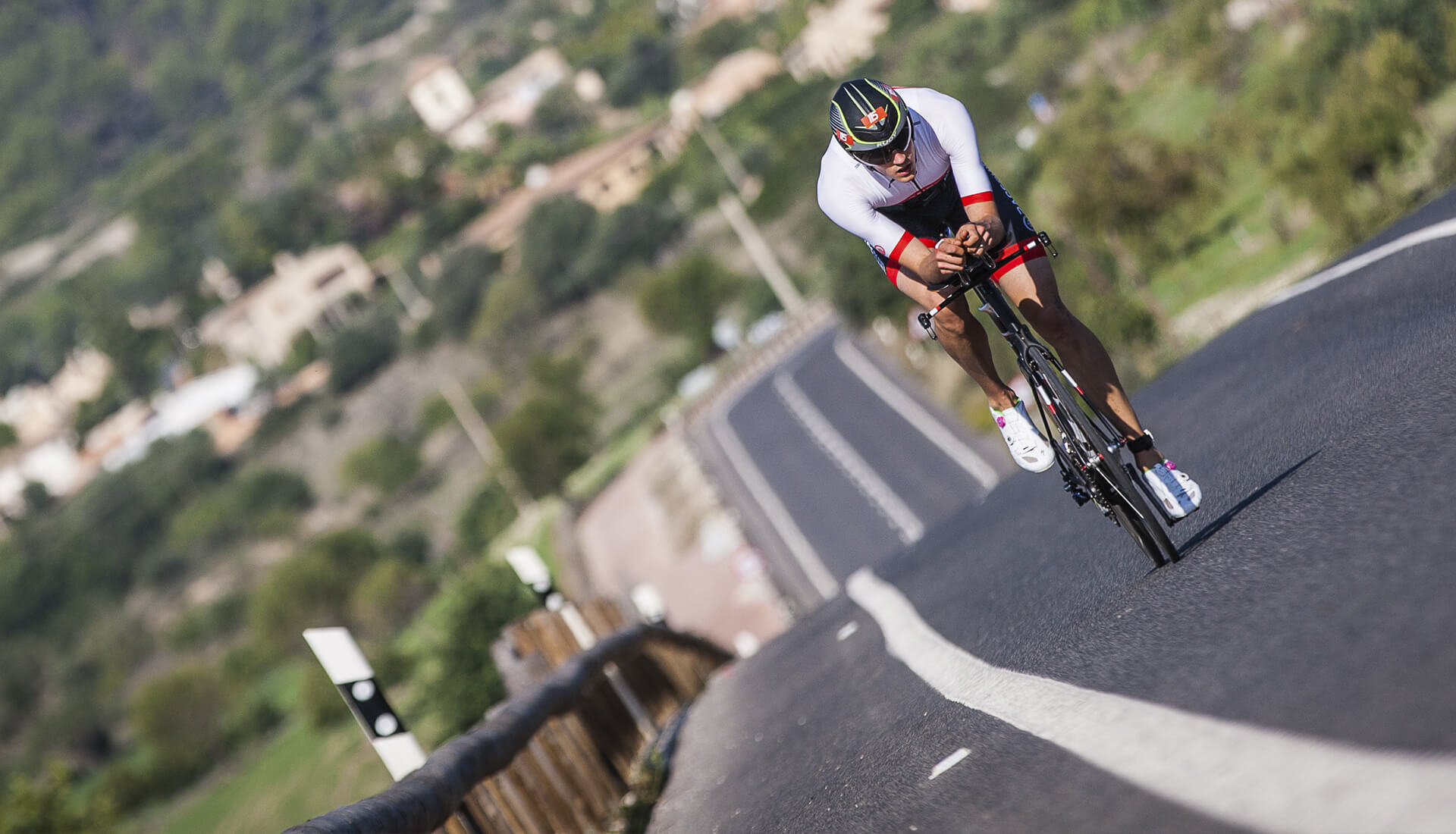
Enjoy cycling in Calvià
If you are a cyclist, then Mallorca is your paradise. The island has everything you need to enjoy your sport to the full. Warm weather for most of the year, world class routes alternating flat and consistent gradients, all associated services, and a short (less than 3 hour) flight from most European capitals.
Why choose Calvià?
If what you’re looking for is:
- VARIETY: combine flat paths with unevenness on your routes. Combine mountain landscapes with others that are completely coastal. Explore traditional Mallorcan villages with some of the most important tourist destinations.
- CONVENIENCE: just 20 minutes from the airport and 15 from the capital, Palma. All areas of Calvià have the necessary services so you don’t have to worry about anything but cycling.
- MULTIPLE AMENITIES: a varied and magnificant offer of accommodation, gastronomy, culture, sport and leisure, awaits you. The aim is for you to enjoy cycling and, at the same time, a holiday on the island.
- “SERRA DE TRAMUNTANA”: Calvià is one of the gateways to the Serra de Tramuntana, a mountain range that will mark the course of our routes, declared a World Heritage Site by UNESCO (United Nations Educational, Scientific and Cultural Organisation). It is an ideal place for cyclists who want to climb.
- ONE MUNICIPALITY, 14 LOCATIONS: the option of choosing the area which best suits your needs: Peguera, Santa Ponça, Magaluf, Palmanova, El Toro, Bendinat, Illetes, Portals Nous.
Cycling in Majorca. Calvià, the ideal destination to enjoy your sport
RB1 - WELCOME TO
CALVIÀ

Start and finish:
TOURIST INFORMATION OFFICE SANTA PONÇA
Direction: Via Puig de Galatzó, 1 · 07180 Santa Ponça, Calvià
Route designed for those people who visit Calvià for the first time and want to get to know the municipality, in addition to being the introductory stage, to stretch their legs and get to know the morphology of the municipality. It is a circular route that runs through some of the main towns of the Municipality of Calvià (Santa Ponça, Palmanova, Calvià, Es Capdellà, Peguera, Santa Ponça).
The route has two very different slopes, one bordering the coast of the municipality, with gentle terrain, and the other going into the inland areas, with a more pronounced topography, without being too demanding.
The section between Peguera and Santa Ponça is done via a service road, connected to a pedestrian walkway (830 metres), which leads to the recovery of the road traffic area.
Cycling in Majorca. Calvià, best place to ride the island
Ruta Wikiloc - Altimetría RB - Archivo GPX

Galería de fotos - RB1


RB2 - Alongside Galatzó
Start and finish:
TOURIST INFORMATION OFFICE SANTA PONÇA
Description:
Route classified as medium mountain. Ideal for making a first reconnaissance of the mountain landscape of the “Serra de Tramuntana” and acclimatising your legs to the climbs. It is a short route, about 44 kilometres, but intense, with the highlight being the climb to Galilea. In addition, the “Coll des Tords” (of Puigpunyent) stretch completes the journey.
Circular route that starts in Peguera to arrive, passing through the beautiful village of Es Capdellà, at the beginning of the ascent to Galilea. Once we reach the top we will be in Galilea, to then continue downhill towards Puigpunyent. From there, we start our way to the last climb, the “Coll des Tords.” After this ascent, we descend to Calvià, to again reach Es Capdellà and finish in Peguera.
This stage takes place on the southern slope of Galatzó, a mountain with mythical legends and amazing charm.
Cycling in Mallorca . Calvià
Ruta Wikiloc - Altimetría RB - Archivo GPX

Galería de fotos - RB2
RB3 - Towards the
west (poniente) Enjoy Peguera
Start and finish:
TOURIST INFORMATION OFFICE PEGUERA
Description:
Route oriented towards the most western points of the island, passing through Port d’Andratx, a picturesque port with deep fishing roots.
We will continue, changing from sea to mountain. We enter some inland villages, such as S’Arracó, Andratx, Es Capdellà, and continue the ascent to Galilea, the highest point on our journey.
The descent is towards Puigpunyent, in the Palma direction, to link up with Calvià. From there we start our way back to Peguera, passing through Es Capdellà.
Cycling in Mallorca – Calvià
Ruta Wikiloc - Altimetría RB - Archivo GPX

Galería de fotos - RB3
RB4 - Na Burguesa
Circuit
Start and finish:
In front of the Magaluf athletics track (Carrer Miño, 07181, Magaluf, Calvià, Islas Baleares, España)
Description:
A route that illustrates the variety of landscapes and terrain of Calvià. “Na Burguesa” is a natural barrier that separates the coast from Calvià and its inland villages. Two completely different areas.
The coastal habitat, with its hustle and bustle, sea landscapes, urban centres, avenues, shopping, service areas, etc.
The rural part, with its characteristic tranquility, typical Mediterranean landscapes, with an entrance into the neighbouring municipality of Puigpunyent, highlighting its upper part, Galilea, a natural viewpoint over the Bay of Palma ( Badia de Palma) and the Calvià coast, which together with the ascent of the “Coll de Sa Creu”, we will have the best postcards of the Mediterranean at our fingertips.
Mountainous difficulties should not be an impediment to undertaking this route, which, being short, has enough contrasts to make it most enjoyable.
Cycling in Majorca – Calvià
Cotas y puntos significativos
Coll des Cucons
- Categoría: 4ª
- Distancia: 1,3 km
- Desnivel: 89 m
- Promedio desnivel: 6,65%
- Pendiente máxima: 9%
Coll de Galilea (Es Capdellà)
- Categoría:3ª
- Distancia: 5,3 km
- Desnivel: 304 m
- Promedio desnivel: 5,60%
- Pendiente máxima: 11%
Coll d’es Tords (Puigpunyent)
- Categoría:4ª
- Distancia: 3,9 km
- Desnivel: 177 m
- Promedio desnivel: 4,54%
- Pendiente máxima: 10%
Coll de Sa Creu
- Categoría: 4ª
- Distancia: 2,5 km
- Desnivel: 177 m
- Promedio desnivel: 4,54%
- Pendiente máxima: 12%
Ruta de ciclismo en Mallorca, desde Calvià.
Ruta Wikiloc - Altimetría RB - Archivo GPX

Galería de fotos - RB4
RB5 - Sunset, tramuntana
Start and finish:
TOURIST INFORMATION OFFICE PEGUERA
Description:
This is a demanding and colourful route. The requirement is determined by the mileage and the ports that we have to overcome (“Colls”, as we call them in Mallorca).
It is a route with little rest, which merges impressive panoramic views. It starts from the southern slope of the “Serra de Tramuntana”, a UNESCO (United Nations Educational, Scientific and Cultural Organisation) World Heritage Site, to reach the northern face of the “Serra”, which leads to the second part of the route, which runs through charming villages such as Sóller, Deià, Valldemossa, Banyalbufar and Estellencs.
The configuration of the road on the northern side builds a kind of cornice on the wild coast of the “Serra”, in which, accompanied by the movement of the sun, gives, if possible, even more enhancement to the natural beauty of these places.
Of the mountainous difficulties that we will encounter on the route, we highlight “Sa Pedrissa”, located more than halfway along the route. It is a constant and tense climb that will test our physical condition.
Cycling in Majorca – Calvià
Ruta Wikiloc - Altimetría RB - Archivo GPX

Galería de fotos - RB5
RB6 - ALMOND TREES
AND WINERIES
Start and finish:
TOURIST INFORMATION OFFICE SANTA PONÇA
Direction: Via Puig de Galatzó, 1 · 07180 Santa Ponça, Calvià
Description:
Route of contrasts. It consists of a simple route, with only slight mountainous difficulties, which make it very bearable. Our challenge to beat on this route will be the distance in kilometres.
Always surrounded by landscape typical of our island, the almond trees will be the focus. Between the months of February and March, they create a spectacular canvas, giving a “totally snowy” effect. Almond blossom in all its splendour.
Another element we find in this route are the vineyards – crops which produce highly appreciated wines on the island, typical of the Raiguer area, and a contrast with the previous landscape.
Cycling in Majorca
Ruta Wikiloc - Altimetría RB - Archivo GPX

Galería de fotos - RB6
RB7 - Mountain Villages,
the archduke (l'Arxiduc)
Start and finish:
TOURIST INFORMATION OFFICE PALMANOVA
Description:
Visiting the villages of Valldemossa and Orient by bicycle is an interesting challenge. The mountainous difficulties that we will have to overcome until we reach these places will force us to make efforts that, once overcome, will be rewarded by the uniqueness of these localities.
Valldemossa, famous for the Archduke Luís Salvador, Frederic Chopin, Santa Catalina Thomas and, the perfect place to taste a potato cake with hot chocolate or almond “horchata” (milky drink), depending on the season of the year.
Once past the “Coll d’Honor” and “es Freu”, we find “Orient”, a small picturesque villlage, in the middle of the mountains.
Cycling in Majorca
Ruta Wikiloc - Altimetría RB - Archivo GPX

Galería de fotos - RB7
RB8 - Orient Valley
(Vall d'Orient)
Start and finish:
TOURIST INFORMATION OFFICE PALMANOVA
Description:
This is a relatively simple route, with two mountainous difficulties incorporated, which due to distance and terrain do not pose excessive effort.
Having passed the “Coll d’Honor” and “es Freu”, we find the small picturesque villlage, in the middle of the mountains – “Orient”, which we will pass to make way for a completely flat route.
Ruta Wikiloc - Altimetría RB - Archivo GPX

Galería de fotos - RB8
RB9 - See and
Vineyards
Start and finish:
Illetes. Passeig Illetes, 7 07181, Calvià, Mallorca, Illes Balears, España
Description:
Simple route, which, except for when leaving the municipality, has no other mountainous difficulties during the remainder of the route, with a reasonable distance and terrain that makes for a peaceful day, enjoying the start/finish contrast of the maritime landscape, as opposed to the rural area with vineyards of the central area of the island.
The low-medium difficulty is determined by the final mileage for a medium level cycling tourist.
Ruta Wikiloc - Altimetría RB - Archivo GPX

Galería de fotos - RB9
RB10 - Puig Major,
the Colossus
Start and finish:
TOURIST INFORMATION OFFICE PEGUERA
Description:
This is a very demanding route, which begins at the top of the Tramuntana Mountains (Serra de Tramuntana), passing through the villages of Estellencs, Banyalbufar and Valldemossa, deviating towards Deià. These delightful villages are “planted” in nature itself. We then reach Sóller to begin the mythical and feared ascent of Puig Major, the colossus of the island of Mallorca.
Extremely demanding continuous climb, requiring all the climbing potential we have.
The return gives continuity to the southern slope of the Serra de Tramuntana, accumulating a high mileage, which, if possible, will make the day even more difficult.
Ruta Wikiloc - Altimetría RB - Archivo GPX

Galería de fotos - RB10
RB11 - From end
to end (cap a cap)
Start and finish:
TOURIST INFORMATION OFFICE SANTA PONÇA
Description:
A trip from one end of the island to the other, considering Calvià as the penultimate westernmost town in Mallorca and “Cap de Formentor” as the easternmost point of the “Serra de Tramuntana”, means that the route to be followed takes us from one end to the other in a single day.
Due to the distance and the climbs to the “Mirador d’Es Colomer” and subsequent arrival at “Cap de Formentor”, the difficulty of this stage is high and it will be a spectacular challenge for experienced cyclists.
Ruta Wikiloc - Altimetría RB - Archivo GPX

Galería de fotos - RB11
Associated Services
BIKE STATION
HOTELS
Peguera
Hotel Diamante ***
Hotel Continental Don Antonio ****
Hotel Universal Lido Park ****
Hotel Valentín Reina Paguera ***
Apartamentos Aldea Cala Fornells **
Apartamentos Flor Los Almendros **
Es Capdellà
Portales Nous
Hotel Sallés Marina Portals ****
Palmanova – Magaluf
Hotel Son Caliu Spa Oasis ****
Hotel Seramar Comodoro Playa ****
Hotel Sol Beach House Mallorca ****
Santa Ponça
Hotel Fergus Style Cala Blanca Suites ****
Hotel Santa Ponsa Pins ****
Hotel Sentido Punta del Mar ****
Apartamentos Vista Club ***